Home
Assessors Office
Clerk's Office
Commissioners Office
DMV-Motor Vehicle
Drivers License
District Court
Elections
Extension Office
GIS Maps
Homeland Security
Human Resources
Indigent
Information Technology
Jury
Magistrate Court
Parks & Recreation
Planning & Zoning
Probation Services
Prosecutors Office
Road & Bridge
Sheriff's Office
Solid Waste
Treasurer / Tax
Veterans
Weed Department

GIS Mapping

|
501 N. Maple #209 Blackfoot, Idaho 83221 Office (208) 782-3173 |
Purchasing
(208) 782-3866
............................
Payment Processing
(208 782-3865
............................
Shelley Shop
(208) 782-3874
............................
Springfield Shop
(208) 782-3869
(208) 782-3866
............................
Payment Processing
(208 782-3865
............................
Shelley Shop
(208) 782-3874
............................
Springfield Shop
(208) 782-3869
Divisions |
Approaches ............................ Conditions ............................ Construction ............................ GIS/Mapping ............................ Load Routes ............................ Mailbox Regs ............................ Ordinances ............................ Right of Way Trenching Permit ............................ Signs ............................ Solid Waste ............................ Transp. Plan |


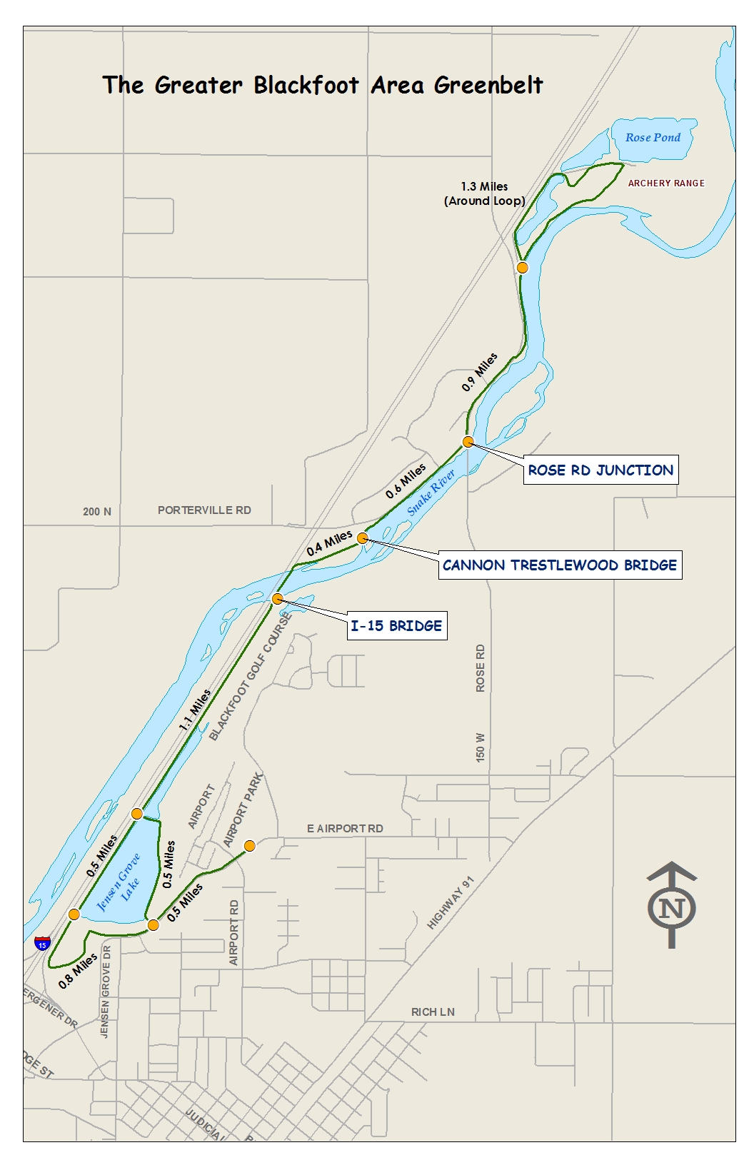
Greenbelt Information |
In 2001 Bingham County contracted with J-U-B Engineering Inc., to develop a Master Transportation Plan (MTP). The MTP was designed to have multi-purposes. One major component of the transportation plan was the conversion of existing digital County maps into a geographic information system (GIS) format.
The county provided a number of survey coordinates throughout the County as a guide to position existing digital mapping data. J-U-B’s GIS group, Gateway Mapping, took those existing digital maps and adjusted them to fit the newly surveyed coordinates. Gateway Mapping developed the base map the county is using today to improve its mapping and data base history of roads, signs, approaches and other mapped layers.
GIS is computer technology that combines maps and data to provide a powerful infrastructure management tool. GIS records inventory, identifies risk or liability problems, provides operations and maintenance direction, and helps establish budgets.
In a more generic sense, GIS is a tool that allows users to create interactive queries (user created searches), analyze the spatial information, edit data, maps, and present the results of all these operations.
Currently, the following Bingham County departments utilize the GIS mapping that has been developed: Appraisers, Assessors, Clerks, Commissioners, Elections, Planning and Zoning, and the Treasurers Offices.
The Master Transportation Plan provided a GIS beginning for the County. This GIS development will continue to build and benefit the County for years to come.


